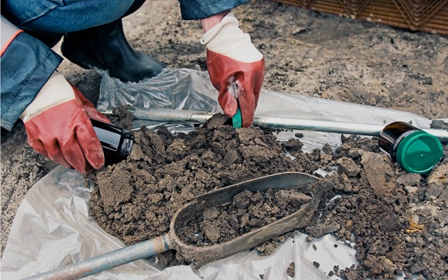
In the Mountain West, sediment is the most common pollutant in our waterways. Whether it is driven by large-scale agricultural operations, industrial land disturbance, or natural watershed destabilization, excess sediment does more than just turn a stream cloudy. It alters aquatic habitats, reduces reservoir capacity, and can serve as a carrier for other regulated pollutants. For land managers and industrial operators, understanding the “sediment story” of a site is a critical part of long-term environmental stewardship.
At Grouse Mountain Environmental Consultants, we provide specialized Sediment and Erosion Sampling. We design and implement the data-driven programs needed to quantify sediment loads and protect the integrity of our regional watersheds.
Quantifying the Load: Erosion Studies & Watershed Assessments
Erosion isn’t just a surface-level problem; it’s a volumetric one. We provide the technical field expertise to measure the impact of land use on water quality:
-
Agricultural & Industrial Erosion Studies: We perform site-specific evaluations to determine how runoff from tilled fields or construction sites is contributing to local sediment loads.
-
Watershed-Scale Assessments: Sediment issues rarely stop at the property line. We look at the “big picture,” assessing how cumulative upstream activities are impacting the stability and water quality of an entire drainage basin.
-
Turbidity & Total Suspended Solids (TSS): We utilize high-precision field meters and laboratory analysis to correlate visual water clarity (turbidity) with the actual mass of sediment (TSS) moving through the system.
Designing Programs for Watershed Stability
A single “grab sample” after a rain event doesn’t provide a complete picture. Effective sediment management requires a program designed to capture the variability of the Western climate:
-
Sediment Load Evaluation: We design sampling schedules that account for “pulse” events such as spring snowmelt or intense summer monsoons to calculate the total annual sediment yield of a site.
-
Watershed Destabilization Identification: We identify the “geomorphic red flags,” such as head cutting, bank slumping, or loss of riparian vegetation, that indicate a system is reaching a tipping point of instability.
-
Erosion Control Efficacy: Are your BMPs (Best Management Practices) actually working? We provide the “before and after” sampling data needed to prove that your silt fences, basins, and reclamation efforts are effectively keeping sediment out of the water.
Why Professional Sediment Sampling is a Business Asset
In the world of environmental permitting and land management, data is your best defense. By partnering with Grouse Mountain, you gain:
-
Regulatory Defensibility: Our sampling protocols meet state and federal standards, providing a robust record that protects you from claims of “unauthorized discharge” or downstream impact.
-
Targeted Mitigation: By identifying exactly where the sediment is entering the system, we help you spend your reclamation and erosion-control budget more effectively.
-
Resource Protection: Accurate sediment data allows for better management of irrigation infrastructure, livestock watering points, and industrial intake systems, reducing long-term maintenance costs.
The Grouse Mountain Difference
We don’t just measure mud; we analyze the health of the landscape. Our team combines technical hydrology with a deep understanding of the agricultural and industrial heritage of Wyoming and the surrounding states. We provide the clear, actionable data you need to manage your land and water resources sustainably.
Ready to ensure your project’s compliance?

