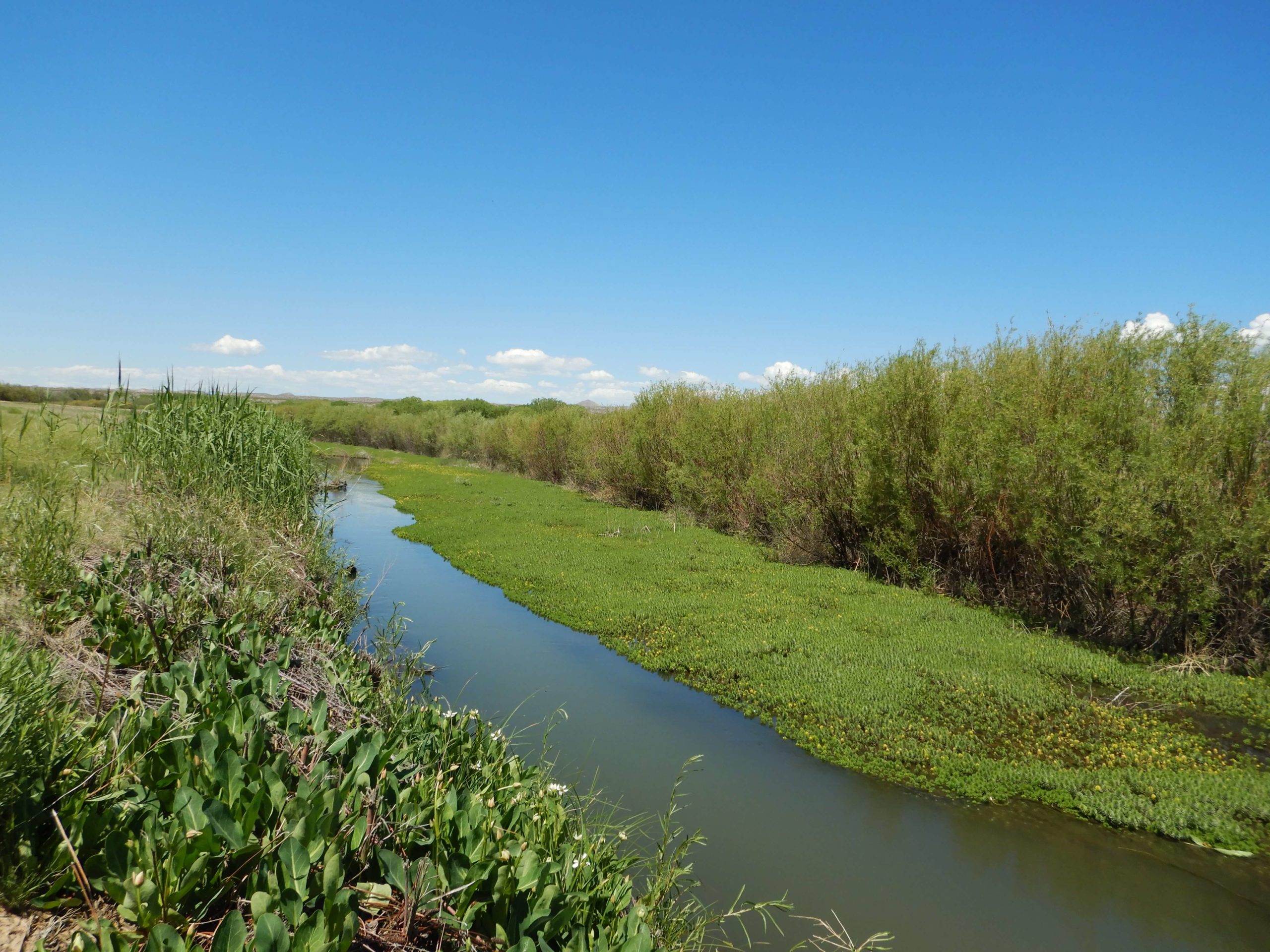
In the high-desert and mountain ecosystems of the West, the health of a stream is the ultimate indicator of the health of the land. A stable, functional riparian zone acts as a natural sponge, filtering pollutants, recharging aquifers, and providing critical corridors for wildlife and livestock alike. However, many of our regional waterways face pressure from historical land use, infrastructure development, and shifting climate patterns.
At Grouse Mountain Environmental Consultants, we specialize in Stream and Riparian Area Assessments. We provide the data-driven insights and design expertise needed to evaluate, monitor, and restore the vital “green ribbons” of the Mountain West.
The Rosgen Standard: Evaluating Stream Function
To fix a stream, you first have to understand its geometry. We utilize the industry-standard Rosgen Classification System to categorize stream types based on their slope, width-to-depth ratio, and bed material. This allows us to perform:
-
Proper Functioning Condition (PFC) Assessments: We determine if a stream is “functioning,” “functional-at-risk,” or “non-functional.” This qualitative assessment is a critical first step in prioritizing restoration dollars.
-
Geomorphic Stability Analysis: By understanding a stream’s natural “evolutionary” state, we can predict whether a channel is likely to remain stable or begin to “headcut” and erode during the next high-water event.
-
Reference Reach Identification: We identify healthy “reference” sections of similar streams to serve as the ecological blueprint for your restoration project.
Advanced Monitoring: AIM, MIM, & Biological Health
Long-term stewardship requires more than a single visit. We establish permanent stream-monitoring sites and utilize standardized federal protocols to track trends over time:
-
Aquatic Inventory & Monitoring (AIM): We provide the rigorous, quantitative data required for BLM and state land-management reporting, focusing on water quality, physical habitat, and biological integrity.
-
Multiple Indicator Monitoring (MIM): Specifically designed for grazing and riparian management, we track “stubble height,” “streambank stability,” and “woody species regeneration” to help land managers balance production with conservation.
-
Benthic & Invertebrate Sampling: The “bugs” tell the story. By sampling the macroinvertebrates living in the stream bed, we provide a biological “report card” of long-term water quality that chemical testing alone might miss.
From Assessment to Action: Stream-Restoration Design
An assessment is only as good as the solution it creates. We translate our field data into practical, buildable Stream-Restoration Designs:
-
Natural Channel Design: We use the land’s own geometry to create stable, self-sustaining channels that reduce erosion and improve sediment transport.
-
Riparian Revegetation: We design planting plans utilizing native willows, sedges, and cottonwoods to “armor” banks naturally and restore shade and habitat.
-
Structure Integration: Where necessary, we design “low-tech” process-based restorations (PBR) or engineered structures that mimic natural debris jams to slow water and trap sediment.
Why Professional Stream Assessment is a Business Asset
Whether you are a private rancher, a government agency, or an industrial developer, understanding your riparian assets is a strategic necessity. By partnering with GMEC, you gain:
-
Defensible Management Data: Our AIM and MIM reports provide the scientific “proof of performance” needed to satisfy regulatory requirements and land-use permits.
-
Infrastructure Protection: By identifying stream instability early, we help you protect bridges, roads, and pipelines from the catastrophic bank failures that occur during spring runoff.
-
Successful Mitigation: If your project requires wetland or stream offsets, our Rosgen-based designs ensure your restoration meets the high “functional lift” standards required for credit release.
The GMEC Difference
We don’t just walk the banks; we understand the system. Our team combines technical hydrology with a deep-rooted knowledge of Western botany and geomorphology. We provide the clear, actionable data you need to manage your water resources for the next generation.
Ready to ensure your project’s compliance?

