Monitoring & Reporting for T&E Species

Species Monitoring

In the lifecycle of a major energy or infrastructure project, the “end” of construction is often just the beginning of a new regulatory phase. Whether your permit includes a Biological Opinion (BO) from the U.S. Fish and Wildlife Service (USFWS) or specific state-level conservation measures, your project’s long-term success depends on documenting that those protections actually worked. Failing to provide accurate, timely monitoring data can lead to permit suspensions, increased mitigation costs, or delays in future project phases.

At Grouse Mountain Environmental Consultants, we provide specialized T&E Species Monitoring and Reporting. We provide the technical field data and administrative oversight needed to maintain ongoing compliance and secure your project’s regulatory standing.

The Science of Compliance: Post-Construction Monitoring

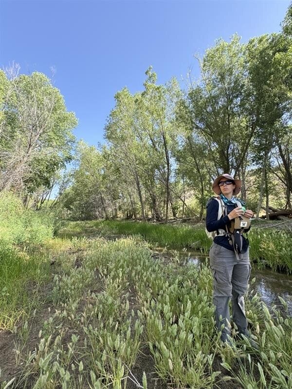
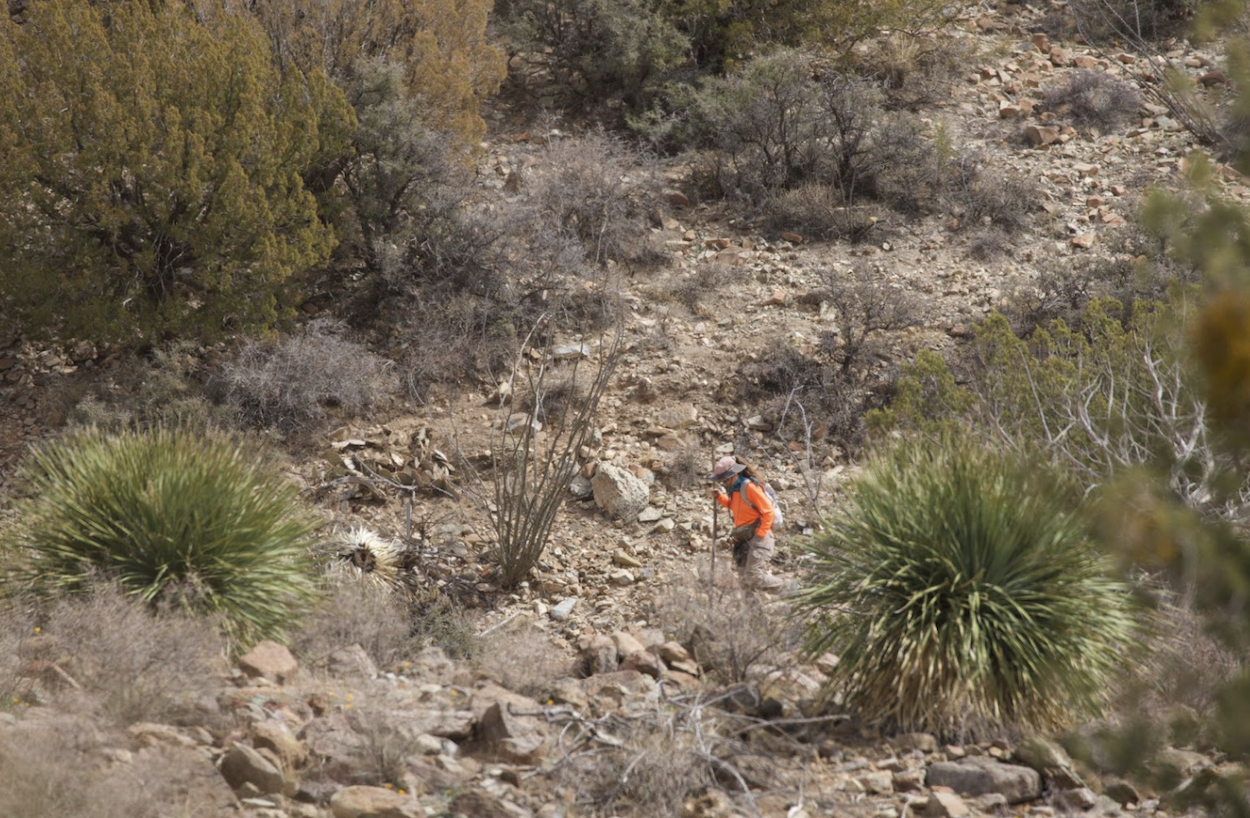
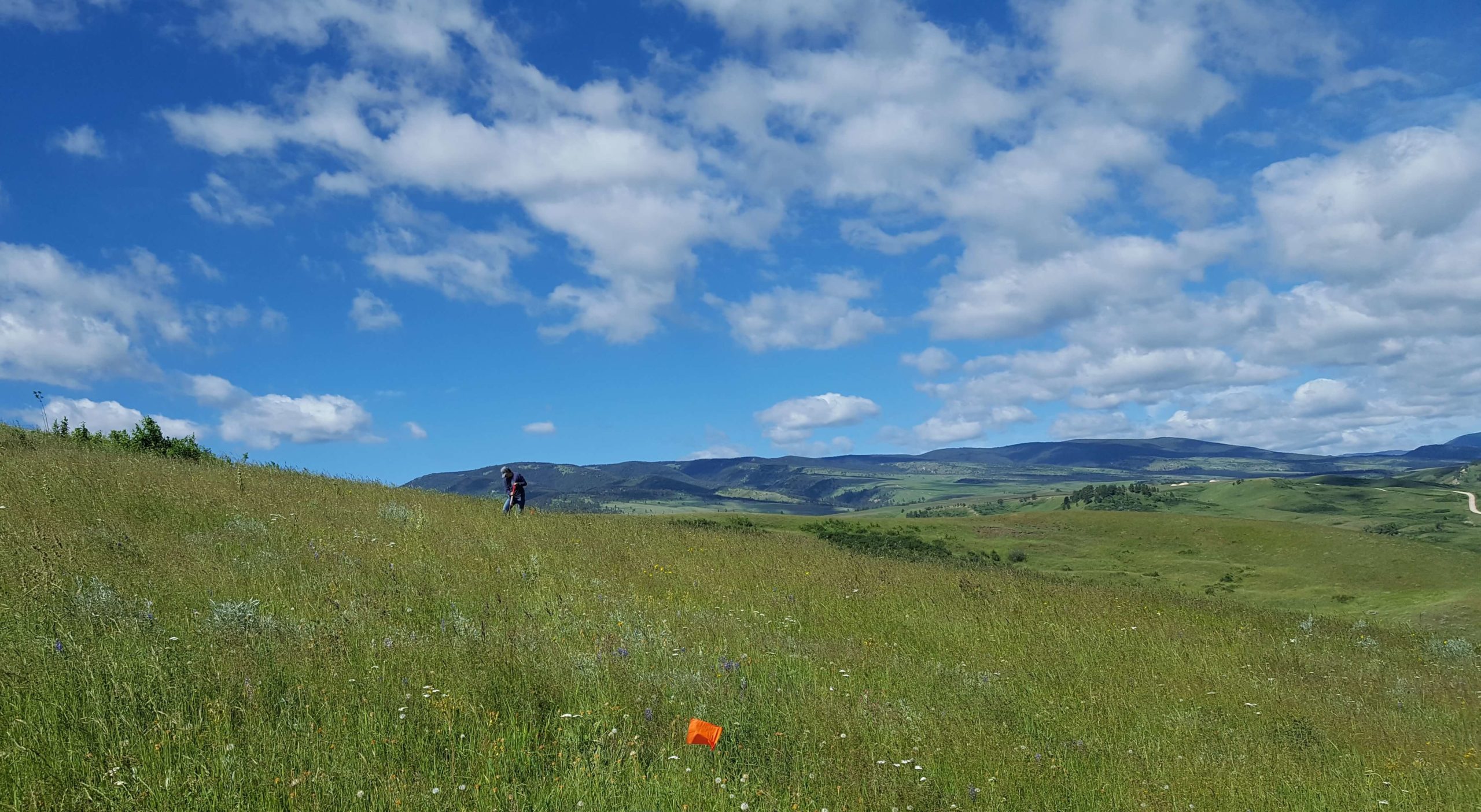
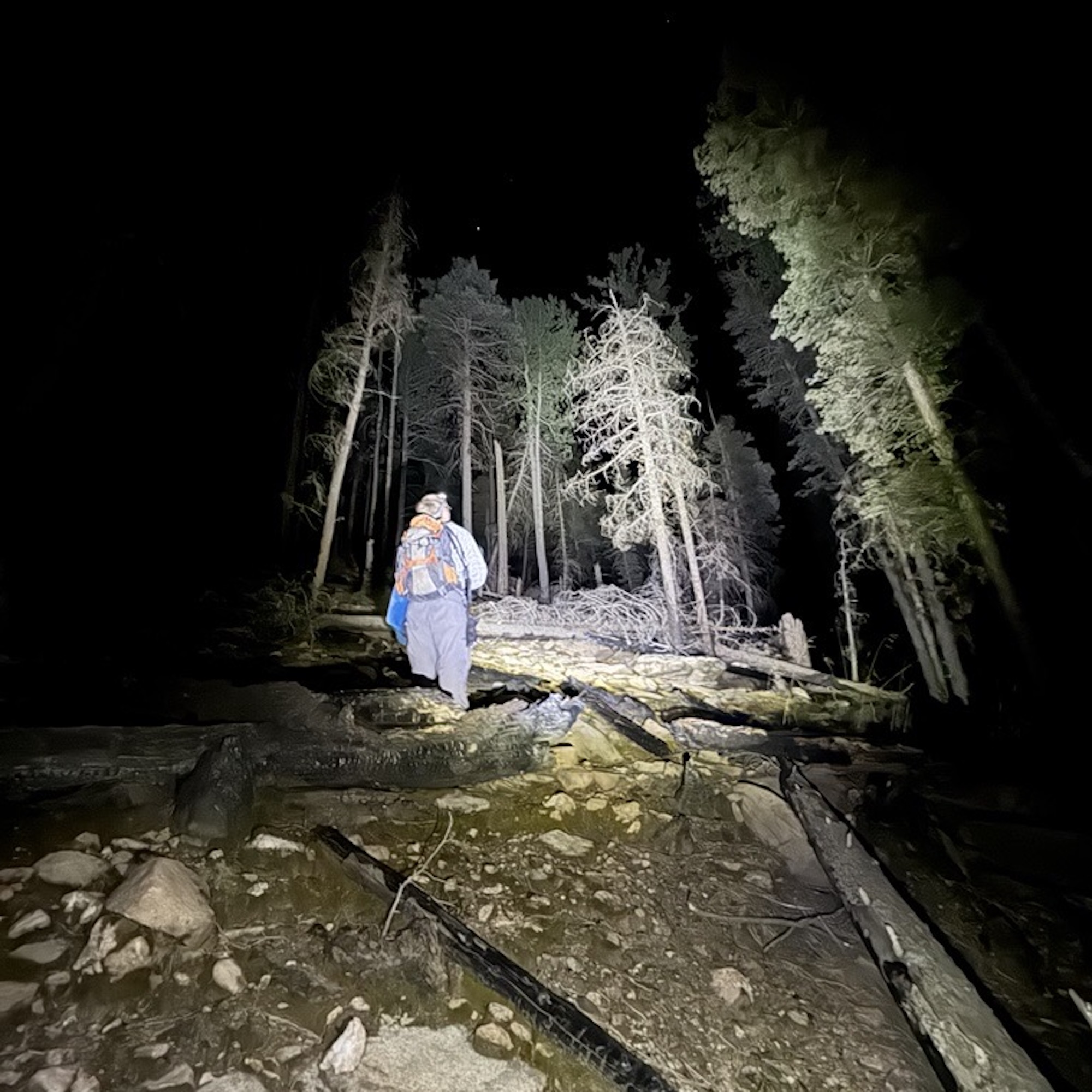
Once the heavy machinery has left the site, the focus shifts to verifying that Threatened and Endangered (T&E) species and their habitats are recovering as predicted. We design and implement systematic monitoring programs:

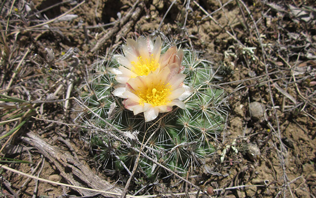
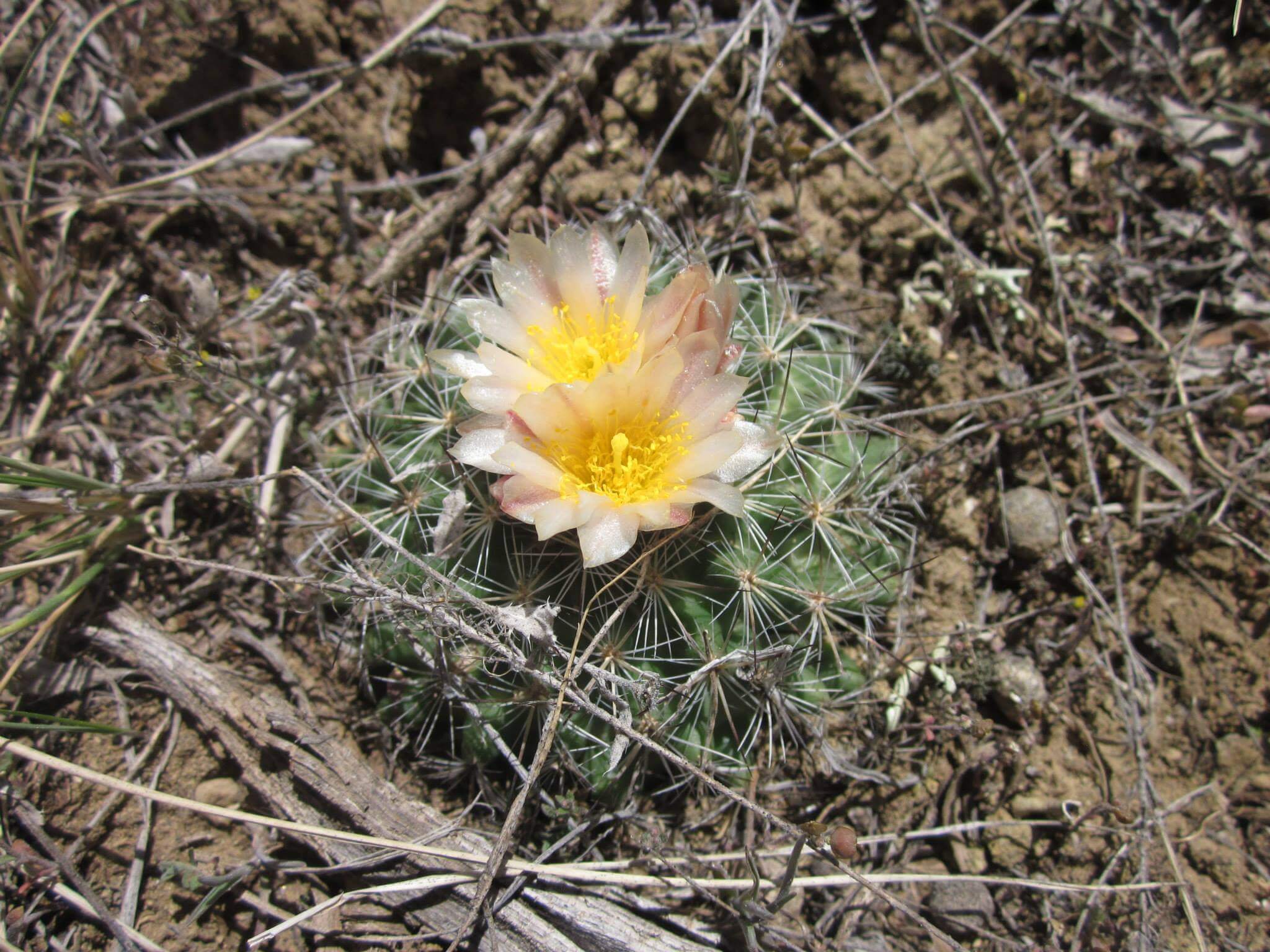
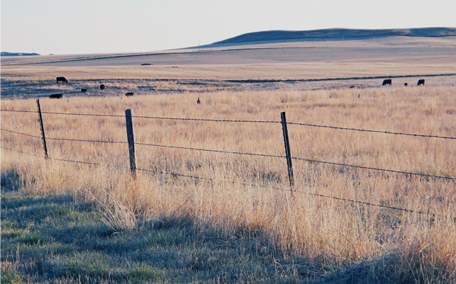
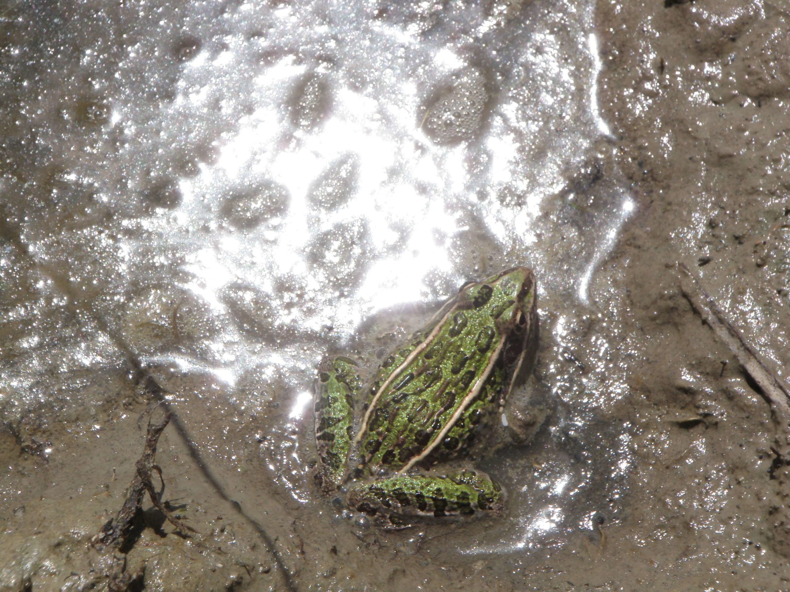
  • Habitat Restoration Tracking: We monitor re-seeded areas to ensure that the specific vegetation required by a species such as the unique host plants for a listed insect or the screening cover for a ground-nesting bird is successfully established.

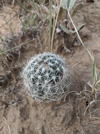
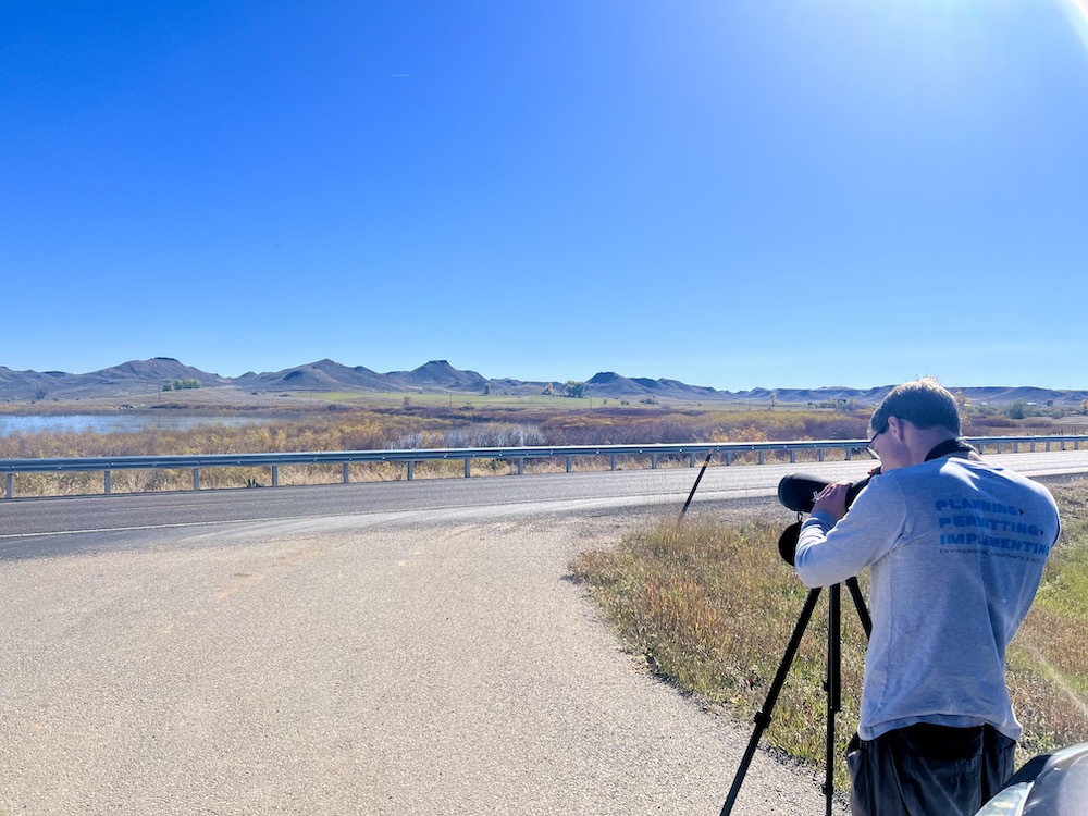
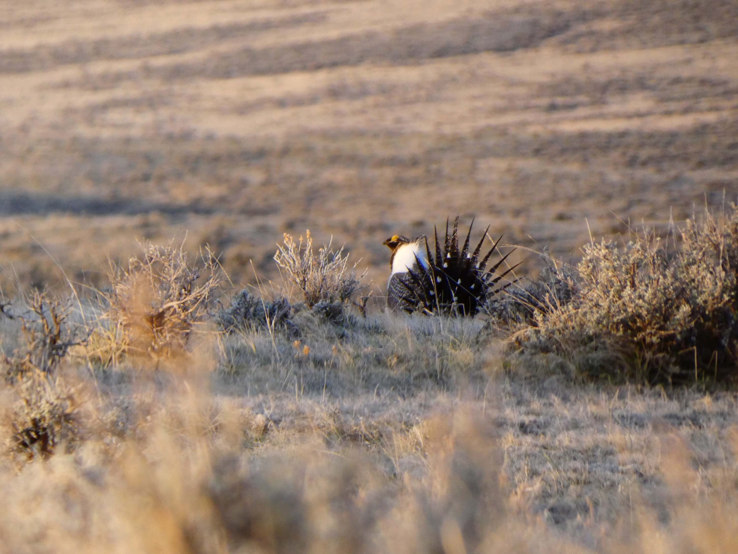
  • Occupancy & Presence Surveys: We perform follow-up inventories to confirm that species like the black-footed ferret or the Ute ladies’-tresses orchid are still utilizing the surrounding habitat or have successfully re-colonized restored zones.

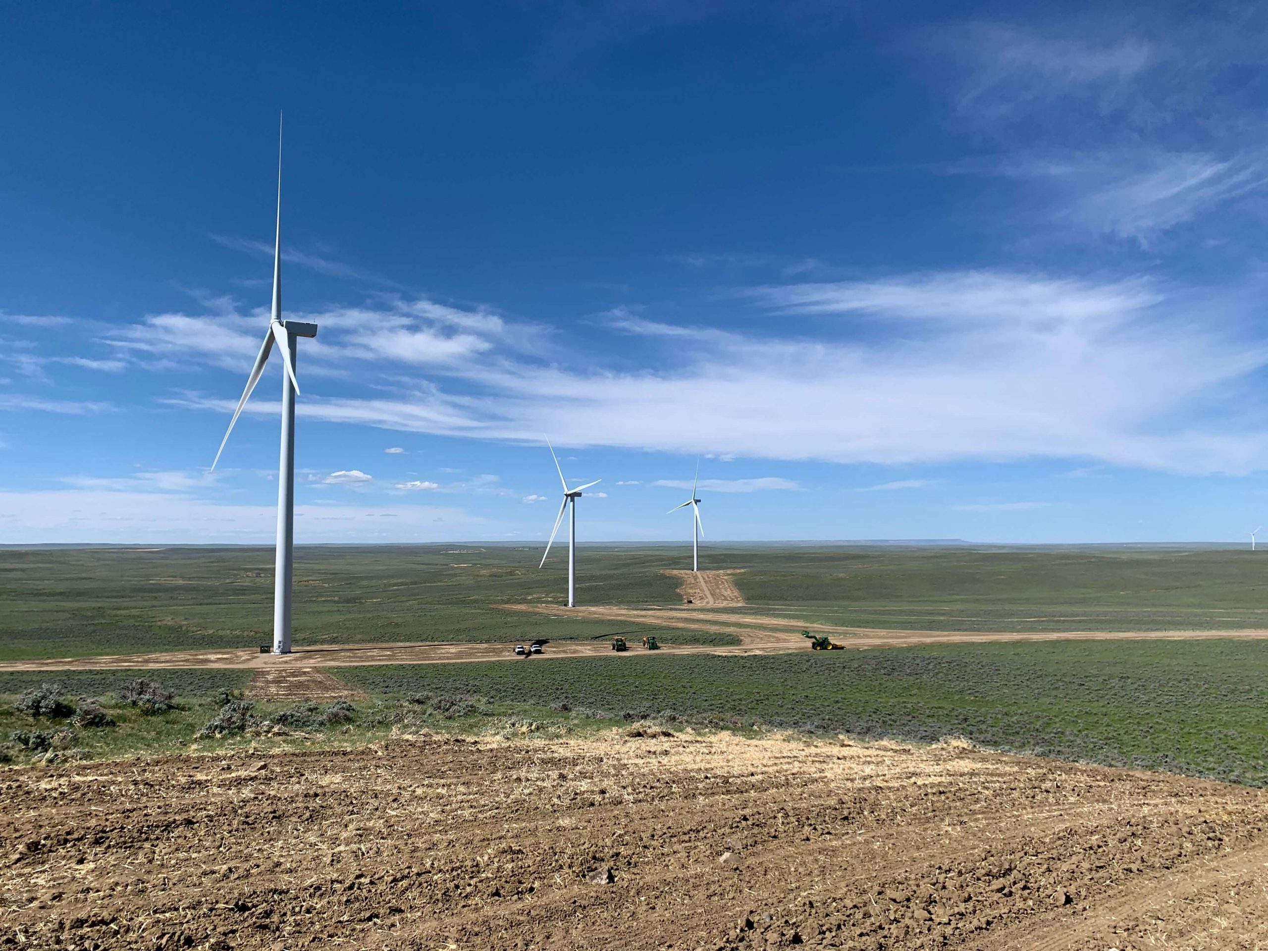
  • Effectiveness Monitoring: Did your “minimization measures” work? We collect the quantitative data needed to prove that noise buffers, dust suppression, or timing restrictions successfully protected the target species during the build phase.

The Technical Record: Reporting to Agency Standards

Data collected in the field is only useful if it is translated into the specific formats that regulators expect. We manage the full documentation cycle:

  • Annual Compliance Reports: Many federal and state permits require yearly updates. We provide clear, data-driven reports that summarize monitoring results, highlight successes, and proactively address any areas of concern.

  • Mitigation Credit Verification: If your project involved compensatory mitigation or “banking,” we provide the independent verification needed to prove that the “habitat lift” has been achieved, allowing for the release of financial bonds or the finalization of credits.

  • Real-Time Adaptive Management: If monitoring reveals that a protection measure isn’t performing as expected, we don’t just report the failure. We provide the “Adaptive Management” recommendations such as adjusting a re-seeding mix or modifying a buffer to get your project back into compliance quickly.

Why Professional Monitoring is a Business Asset

In environmental consulting, “closing the loop” on a permit is a strategic necessity. By partnering with GMEC for your monitoring and reporting, you gain:

  1. Bond Release Efficiency: For mining and large-scale energy projects, a rigorous monitoring record is the fastest path to proving that reclamation is successful and securing the release of financial guarantees.

  2. Regulatory Good Will: Providing high-quality, transparent reporting builds trust with agency biologists, making the permitting process for your next project significantly smoother.

  3. Liability Protection: A professional monitoring record provides a legal “shield,” proving that your project operated within the bounds of its permits and avoided unauthorized “take” of a protected species.

The GMEC Difference

We don’t just “check boxes”; we provide technical advocacy. Our team understands the specific ecological nuances of the Wyoming basins and the broader Western region. We provide the technical depth of a specialized firm with the practical, “solution-oriented” mindset needed to see your project through to its final regulatory sign-off.

Ready to ensure your project’s compliance?

Contact Grouse Mountain Environmental Consultants today for a consultation.
Learn more about our threatened and endangered species surveys.

Avoidance & Minimization for T&E Species

T&E Avoidance & Minimization Measures

In environmental permitting, the most cost-effective way to manage a Threatened or Endangered (T&E) species is to never impact it in the first place. For energy developers, telecommunications firms, and infrastructure planners, the presence of a protected species doesn’t have to trigger an exhaustive, multi-year formal consultation. Often, the difference between a project that stalls and one that moves forward is a proactive Avoidance and Minimization Strategy.

At Grouse Mountain Environmental Consultants, we specialize in developing site-level solutions that balance operational goals with the strict compliance expectations of the U.S. Fish and Wildlife Service (USFWS) and state agencies.

Avoidance by Design: The Gold Standard of Permitting

The “Avoidance-Minimization-Mitigation” hierarchy is the bedrock of the Endangered Species Act (ESA). Our team works alongside your engineers to implement “Avoidance by Design” at the earliest possible stage:

  • Route & Facility Micro-Siting: By utilizing high-resolution habitat mapping, we identify “no-go” zones. Shifting a well pad or a pipeline right-of-way by just a few hundred feet can often move a project entirely out of Critical Habitat, bypassing the need for formal Section 7 consultation.

  • Habitat Connectivity Preservation: We identify the movement corridors and “pockets” of essential habitat that must remain undisturbed to maintain the biological integrity of a local population.

  • Infrastructure Optimization: We recommend technical adjustments such as utilizing existing road networks or co-locating utilities to reduce the overall “new” footprint of a project in sensitive areas.

Minimization Measures: Reducing the Footprint of Impact

When total avoidance isn’t feasible, the focus shifts to minimizing the “intensity” and “duration” of the impact. We develop custom, site-specific measures that meet agency standards:

  • Seasonal & Timing Restrictions: We help you build a construction schedule that avoids critical biological windows, such as the nesting season for raptors or the flowering period of a rare orchid like the Ute ladies’-tresses.

  • Construction Best Practices: We design protocols for dust suppression, noise reduction, and light shielding to minimize the “indirect” effects of development on nearby sensitive species.

  • Integrated Reseeding & Reclamation: We create specialized seed mixes and soil-handling protocols to ensure that once construction is complete, the habitat returns to a functional state as quickly as possible.

Why a Proactive Strategy is a Business Asset

In environmental consulting, “proactive” is synonymous with “profitable.” By partnering with GMEC to develop your avoidance and minimization plans, you gain:

  1. Accelerated Concurrence: Agencies are far more likely to issue a “Not Likely to Adversely Affect” (NLAA) determination when a project demonstrates a clear, documented effort to avoid sensitive resources.

  2. Lower Long-Term Costs: Avoiding an impact today is significantly cheaper than paying for compensatory mitigation, habitat offsets, or multi-year post-construction monitoring tomorrow.

  3. Regulatory Credibility: Building a reputation for “Avoidance by Design” creates a smoother relationship with agency biologists, leading to more predictable timelines for future projects.

The GMEC Difference

We don’t just report “problems” in the field; we provide spatial and technical solutions. Our team understands the specific ecological nuances of the Wyoming basins and the operational realities of the industrial sector. We provide the technical depth of a national firm with the “get-it-done” perspective of a regional partner.

Ready to ensure your project’s compliance?

Contact Grouse Mountain Environmental Consultants today for a consultation.
Learn more about our threatened and endangered species surveys.

Agency Coordination & T&E Documentation

Section 7 Consultation & Biological Assessments

In federal permitting, a successful field season is only the first step. Whether you have confirmed the presence of a protected species or proven its absence through rigorous protocol, that data must be translated into the specific, high-standard language of the U.S. Fish and Wildlife Service (USFWS) and other federal and state agencies. A single technical error in your biological documentation can stall a multi-million dollar energy or infrastructure project just as effectively as a physical barrier.

At Grouse Mountain Environmental Consultants, we provide specialized Agency Coordination and Documentation. We bridge the gap between field biology and the administrative requirements of the Endangered Species Act (ESA).

The Technical Core: Biological Assessments (BAs)

When a project has a “federal nexus”, meaning it involves federal funding, land, or permits, the Section 7 consultation process is triggered. We provide the technical backbone for this critical phase:

  • Biological Assessment (BA) Preparation: We draft the comprehensive documents required to evaluate the potential effects of a project on listed and proposed species and designated critical habitat.

  • Effect Determinations: We provide the scientific justification for “No Effect,” “May Affect, Not Likely to Adversely Affect,” or “Likely to Adversely Affect” determinations, giving agency biologists the clear data they need for concurrence.

  • Mitigation & Minimization Measures: We design practical, project-specific conservation measures such as timing restrictions or noise buffers, that satisfy regulatory requirements while maintaining operational viability.

Navigating Section 7 & State Consultations

The path to a Biological Opinion (BO) or a letter of concurrence is often a complex negotiation. We act as your technical advocate throughout the lifecycle of your project:

  • Section 7 Consultation Support: We lead the “informal” and “formal” consultation processes, coordinating directly with the USFWS to address concerns and refine project parameters early.

  • State Agency Liaison: We coordinate with state wildlife agencies (such as the WGFD) to ensure your project respects state-specific species of concern and sensitive habitat designations.

  • Administrative Record Management: We maintain a rigorous, defensible record of all agency communications and survey results, protecting your project from future legal challenges or “re-initiation” of consultation.

Why Professional Coordination is a Business Asset

In environmental consulting, “clearance” is the goal, and “defensibility” is the shield. By partnering with GMEC, you gain:

  1. Reduced “Request for Information” (RFI) Cycles: By submitting reports that follow exact agency formatting and address common biological concerns upfront, we bypass the back-and-forth delays that plague the permitting process.

  2. Strategic Problem Solving: If a species conflict arises, we don’t just report the problem; we provide the spatial and technical solutions to navigate it, such as “Avoidance by Design” or “Micro-Siting” infrastructure.

  3. Project Continuity: From initial scoping through construction monitoring and final reclamation, we ensure your biological compliance remains consistent across all federal and state documents.

The GMEC Difference

We aren’t just “field biologists”; we are regulatory navigators. Our team understands the specific policies of the Wyoming basins and the broader Rocky Mountain and Great Plains regions. We provide the technical depth of a national firm with the local relationships and “boots-on-the-ground” knowledge of a regional partner.

Ready to ensure your project’s compliance?

Contact Grouse Mountain Environmental Consultants today for a consultation.
Learn more about our threatened and endangered species surveys.

Habitat Assessments and Mapping for T&E Species

T&E Habitat Assessments

In environmental permitting, the most valuable map isn’t always the one showing where a species lives, it’s the one showing where it could live. For energy developers, infrastructure planners, and land managers in the West, identifying potentially suitable habitat for Threatened and Endangered (T&E) species is a critical first step. It is the difference between a streamlined categorical exclusion and a multi-year Environmental Impact Statement.

At Grouse Mountain Environmental Consultants, we specialize in T&E Habitat Assessments and Mapping. We combine advanced spatial modeling with “boots-on-the-ground” field validation to provide a clear, defensible roadmap of your project’s biological risks.

The Predictive Power of Species Distribution Models

In the vast expanses of Wyoming and the surrounding states, surveying every acre is often logistically impossible. We use Species Distribution Modeling (SDM) to narrow the search:

  • Spatial Analysis Tools: We utilize high-resolution Geographic Information Systems (GIS) to layer environmental variables like soil type, elevation, aspect, and distance to water.

  • Habitat Probability Mapping: By analyzing these factors, we create “heat maps” that rank your project area’s suitability for specific species, from the Ute ladies’-tresses orchid in riparian zones to the black-footed ferret in prairie dog complexes.

  • Early Siting Support: Our models allow your engineers to “design around” high-probability habitat during the initial planning phase, potentially bypassing the need for intensive presence/absence surveys later.

Ground-Truthing: Field-Based Habitat Evaluations

A digital model is a powerful guide, but the U.S. Fish and Wildlife Service (USFWS) requires physical verification. Our biologists take the office data into the field to confirm the reality of the landscape:

  • Micro-Habitat Observations: We look for the subtle “indicators” that a map might miss: specific host plants for insects, unique rock crevices for bats, or the precise soil moisture levels required for rare flora.

  • Habitat Quality Scoring: Not all suitable habitat is created equal. We evaluate the current “rank” of an area, helping regulators understand if a site is a critical corridor or a low-functioning marginal zone.

  • Negative Determination Reports: If our field evaluation proves that the physical or biological features (PBFs) required for a species are absent, we provide the technical record needed to request a “No Effect” concurrence from federal agencies.

Why Habitat Mapping is a Business Asset

In environmental consulting, information is the best defense against project delays. By partnering with GMEC, you gain:

  1. Avoidance by Design: By identifying and avoiding high-probability habitat during the design phase, you can often significantly shorten the time required for agency concurrence and Section 7 consultations.

  2. Strategic Survey Allocation: Instead of a “blanket” survey of your entire project area, our habitat assessments allow us to focus expensive, protocol-driven field work only where it is truly necessary.

  3. Defensible NEPA Documentation: Our integrated reports provide the rigorous “Affected Environment” data that federal agencies require for Environmental Assessments (EA) and Impact Statements (EIS).

The GMEC Difference

We don’t just produce “pretty maps”. We provide regulatory strategies. Our team understands the specific ecological nuances of the Mountain West and the Great Plains. We provide the technical depth of a specialized GIS firm with the practical, “get-it-done” perspective of a regional field partner.

Ready to ensure your project’s compliance?

Contact Grouse Mountain Environmental Consultants today for a consultation.
Learn more about our threatened and endangered species surveys.

Targeted Threatened and Endangered Species Surveys

T&E Species Survey

In the Mountain West and Great Plains, a single federal listing can change the entire trajectory of a project. Whether you are developing a wind farm, siting a pipeline, or managing a municipal expansion, the presence of a Threatened or Endangered (T&E) species requires more than just a general biological survey. It requires a systematic, species-specific approach that meets the rigorous evidentiary standards of the U.S. Fish and Wildlife Service (USFWS).

At Grouse Mountain Environmental Consultants, we specialize in Targeted T&E Species Surveys. We provide the technical expertise and federal permit authorizations needed to clear your project area for the region’s most sensitive inhabitants.

Species-Specific Expertise: From Orchids to Mammals

Every T&E species has a unique “protocol” for identification. A survey for a rare orchid looks nothing like a survey for a cryptic mammal. We provide authorized biologists for the region’s primary species of concern:

  • Ute Ladies’-Tresses Orchid (Spiranthes diluvialis): We conduct intensive inventories during the critical flowering window (typically July–August) in riparian and wetland habitats to confirm presence or absence.

  • Black-Footed Ferret (Mustela nigripes): In areas with active prairie dog colonies, we provide the specialized nocturnal spotlighting and burrow mapping required to meet federal clearance protocols.

  • Northern Long-Eared Bat (Myotis septentrionalis): With shifting listing statuses and white-nose syndrome concerns, we provide acoustic monitoring and habitat assessments to ensure your project stays compliant with evolving bat protection guidelines.

  • Proposed & Candidate Species: We track species “on the bubble” for listing, helping you gather baseline data now to “future-proof” your project against upcoming regulatory changes.

The Systematic Approach: Why Methodology Matters

In the world of the Endangered Species Act (ESA), the process is just as important as the result. Our targeted surveys are designed to be “audit-ready”:

  1. Protocol Adherence: We utilize the exact survey grids, timing windows, and weather constraints mandated by the USFWS and state wildlife agencies.

  2. Qualified Personnel: Our team consists of biologists who hold the specific federal recovery permits required to handle or conduct intrusive surveys for protected species.

  3. Defensible Negative Data: If a species is not found, we provide the rigorous documentation needed to prove it isn’t there, allowing agencies to issue a “Finding of No Effect” or “Not Likely to Adversely Affect.”

Why a Targeted T&E Species Survey is a Strategic Asset

A T&E discovery doesn’t have to be a project-killer, but an unexpected discovery during construction almost always is. By partnering with GMEC, you gain:

  • Avoidance-by-Design: Identifying a population during the planning phase allows you to shift infrastructure by a few hundred feet, potentially bypassing months of formal consultation.

  • Section 7 Consultation Support: If impacts are unavoidable, our data provides the technical backbone for the Biological Assessment (BA) needed for USFWS concurrence.

  • Permitting Confidence: We provide the “science” that your legal and regulatory teams need to move forward with certainty, knowing the biological risks have been fully quantified.

The GMEC Difference

We don’t just “look for animals and plants”; we navigate the Endangered Species Act. Our team understands the specific nuances of the Wyoming basins and the surrounding Western states. We provide the technical depth of a national firm with the local “boots-on-the-ground” agility needed to meet tight seasonal survey windows.

Ready to ensure your project’s compliance?

Contact Grouse Mountain Environmental Consultants today for a consultation.
Learn more about our threatened and endangered species surveys.

Sensitive Plant Support for Energy & Infrastructure

Environmental Compliance for Energy & Infrastructure

In the Mountain West, project success is defined by the ability to move from “concept” to “construction” without hitting a regulatory wall. Whether you are laying miles of natural gas pipeline, siting a massive wind farm, or developing a new solar array, the biological footprint of your project is under intense scrutiny. In these high-stakes environments, a single sensitive plant population can determine the viability of a multi-million dollar investment.

At Grouse Mountain Environmental Consultants, we provide specialized Energy, Infrastructure, and Development Support. We integrate expert botanical science directly into the complex engineering and permitting workflows of the modern industrial sector.

Multi-Sector Expertise: From Pipelines to Renewables

Different industries face different botanical hurdles. We tailor our survey and mitigation strategies to the specific footprint and regulatory “nexus” of your project:

  • Linear Infrastructure (Pipelines & Transmission): We manage the high-volume data needs of long-range corridors, identifying rare plant “hotspots” across diverse soil types and jurisdictions to ensure seamless route clearance.

  • Renewable Energy (Wind & Solar): Large-scale land disturbance requires intensive baseline surveys. We help wind and solar developers navigate the “Permanent Loss of Habitat” calculations required for federal and state permits.

  • Mining & Traditional Energy: For high-impact, long-term projects, we provide the botanical life-cycle support needed for initial permitting, annual compliance monitoring, and final bond release.

Survey Integration: The Holistic Compliance Approach

A sensitive plant survey shouldn’t exist in a vacuum. We specialize in Survey Integration, ensuring that your botanical data works in harmony with your broader environmental compliance efforts:

  • NEPA Document Synchronization: We ensure that our rare plant findings are seamlessly integrated into your Environmental Assessments (EA) or Impact Statements (EIS), providing the technical consistency that regulators demand.

  • Civil Engineering Collaboration: We speak the language of “alignment and grade.” Our botanists work directly with your surveyors and engineers to provide real-time feedback on “micro-siting” infrastructure to avoid sensitive populations.

  • Multi-Disciplinary Field Teams: By coordinating our plant surveys with wildlife and cultural resource inventories, we reduce “trip fatigue” and minimize the logistical costs of field mobilization.

Why Botanical Expertise is a Development Asset

In the energy sector, “uncertainty” is a cost. By partnering with GMEC, you gain:

  1. Streamlined Permitting: Our “Agency-Ready” reports are designed to meet the specific formatting and data standards of the BLM, USFS, and state agencies, reducing the time spent in the “Review and Revise” cycle.

  2. Risk Mitigation: Early identification of sensitive species allows for “Avoidance by Design,” which is significantly more cost-effective than post-discovery re-routing or compensatory mitigation.

  3. Operational Continuity: We maintain a rigorous administrative record of your botanical clearances, protecting your project from legal challenges and ensuring compliance across multi-year construction phases.

The GMEC Difference

We understand that your project has a deadline. Our team combines deep technical expertise in Western botany with a practical, “results-oriented” approach to industrial development. We provide the technical depth of a specialized firm with the scalability needed to support the largest infrastructure projects in the region.

Ready to ensure your project’s compliance?

Contact Grouse Mountain Environmental Consultants today for a consultation.
Learn more about our sensitive plant services.

Mitigation & Project Siting for Sensitive Plants

Mitigation Strategy & Project Siting

In the early stages of an energy or infrastructure project, a map is more than just a set of coordinates, it is a strategic plan. When sensitive plant species are present, the difference between a project that moves forward and one that stalls in the permitting phase often comes down to a few hundred feet of route alignment. For project managers, the goal is simple: achieve operational objectives while minimizing the environmental footprint and the high costs of federal mitigation.

At Grouse Mountain Environmental Consultants, we provide specialized Mitigation Strategy and Project Siting Support. We help you “micro-site” your infrastructure to navigate botanical hurdles with precision and regulatory confidence.

Avoidance by Design: Strategic Facility Siting

The most effective mitigation strategy is the one that happens before a single stake is driven into the ground. We work alongside your engineering and survey teams to optimize your project’s footprint:

  • Route Alignment Consultation: Whether you are siting a pipeline, a transmission line, or a new access road, we identify the “path of least resistance” that avoids known sensitive plant populations and high-probability habitats.

  • Facility Siting Support: From well pads to substations, we provide the botanical data needed to shift facilities to less sensitive soil types, potentially bypassing the need for intensive Section 7 consultations.

  • Pre-Construction Micro-Siting: Once a general route is established, we perform the detailed field checks to “fine-tune” the placement of poles, anchors, and pads, ensuring they miss individual protected plants by the required margins.

Proactive Protection: Buffers & Timing Restrictions

When a project area contains sensitive species, “avoidance” isn’t just about distance; it’s about timing and protection. We provide the technical recommendations that agencies like the BLM and USFWS require for approval:

  • Establishment of Buffers: We determine the scientifically sound “no-disturbance” zones needed to protect the hydrologic and soil needs of a rare plant population during construction.

  • Timing Restrictions: We help you plan your construction schedule to avoid critical biological windows, such as flowering or seed-set periods, reducing the risk of “unauthorized take.”

  • Custom Reseeding Plans: If a disturbance is unavoidable, we design site-specific reclamation mixes that utilize native, non-competitive species to ensure protected plants can re-establish without being choked out by aggressive grasses.

Why Strategic Siting is a Business Asset

In the world of environmental permitting, a “proactive” design is a “profitable” design. By partnering with GMEC, you gain:

  1. Lower Mitigation Costs: By maximizing avoidance during the design phase, you significantly reduce the financial burden of long-term monitoring and compensatory mitigation.

  2. Regulatory Good Will: Agencies favor projects that demonstrate a clear “Avoidance-Minimization-Mitigation” hierarchy. This transparency builds trust and can accelerate the concurrence process.

  3. Reduced Construction Delays: By identifying “no-go” zones early, you prevent the mid-construction work stoppages that occur when a sensitive species is discovered unexpectedly in the right-of-way.

The GMEC Difference

We don’t just point out problems; we provide the spatial solutions. Our team understands the topography of the Wyoming basins and the operational needs of the industrial sector. We provide the technical depth of a specialized botanical firm with the practical, “solution-oriented” mindset needed to get your project built.

Ready to ensure your project’s compliance?

Contact Grouse Mountain Environmental Consultants today for a consultation.
Learn more about our sensitive plant services.

Strategic Regulatory Coordination & Reporting for Sensitive Plants

sensitive plants reporting

In environmental permitting, a successful field season is only half the battle. Whether you have discovered a population of rare orchids or confirmed a project area is clear of sensitive species, that data must be translated into the specific, rigorous language of federal and state agencies. A poorly formatted report or a misunderstood regulatory trigger can stall a multimillion-dollar project just as effectively as a physical barrier.

At Grouse Mountain Environmental Consultants, we provide specialized Regulatory Coordination and Reporting. we bridge the gap between botanical science and the administrative requirements of the BLM, USFS, and USFWS.

Agency-Standard Reporting: Speaking the Language of the Bureaucracy

Federal agencies have exacting standards for how sensitive plant data is collected, mapped, and submitted. We ensure your project’s botanical record is “audit-ready” from day one:

  • BLM & USFS Compliance: We prepare survey reports that follow the specific regional supplements and technical notes required by the Bureau of Land Management and the U.S. Forest Service.

  • USFWS Section 7 Consultations: If your project has a “federal nexus” and may affect a listed species, we provide the biological evaluations needed for formal or informal consultation under the Endangered Species Act (ESA).

  • GIS-Integrated Documentation: Our reports don’t just describe the landscape; they map it with sub-meter precision, providing the digital shapefiles and metadata that agency specialists need for their internal databases.

The NEPA Process: Integrating Botany into Planning

Sensitive plant data is a core component of the National Environmental Policy Act (NEPA). We provide the technical backbone for the botanical sections of your environmental documents:

  • Environmental Assessments (EA): We draft the “Affected Environment” and “Environmental Consequences” sections, providing a clear analysis of how your project might impact sensitive plant populations.

  • Finding of No Significant Impact (FONSI) Support: By proposing scientifically sound avoidance and minimization measures, we help you reach a FONSI decision more efficiently.

  • Mitigation & Monitoring Plans: If impacts are unavoidable, we design the long-term monitoring and reclamation protocols that agencies require as a condition of your permit.

Why Professional Regulatory Coordination is a Business Asset

In environmental consulting, “clearance” is the goal, and “defensibility” is the shield. By partnering with GMEC, you gain:

  1. Reduced “Request for Information” (RFI) Cycles: By submitting reports that already address the common questions and concerns of agency biologists, we help you bypass the back-and-forth delays that often plague the permitting process.

  2. Strategic Negotiation: We act as your technical advocate during agency meetings, using our data to negotiate realistic avoidance buffers and timing limitations.

  3. Project Continuity: We maintain the administrative record of your botanical surveys across multi-year project lifecycles, ensuring that as staff or agency personnel change, your project’s compliance history remains intact.

The GMEC Difference

We aren’t just “botanists”; we are regulatory navigators. Our team understands the specific policies of the Wyoming basins and the broader Rocky Mountain region. We provide the technical depth of a national firm with the local relationships and “boots-on-the-ground” knowledge of a regional partner.

Ready to ensure your project’s compliance?

Contact Grouse Mountain Environmental Consultants today for a consultation.
Learn more about our sensitive plant services.

Strategic Habitat Identification & Modeling

Habitat Identification & Modeling

In the vast, interconnected landscapes of the Mountain West, knowing where a sensitive plant species might be is often as important as knowing where it is. For project managers, the ability to predict suitable habitat before a single shovel hits the dirt is a game-changer for budgets and timelines. It allows for “Avoidance by Design,” shifting infrastructure to less sensitive ground long before a regulatory agency raises a red flag.

At Grouse Mountain Environmental Consultants, we specialize in Habitat Identification and Modeling. We combine advanced geospatial analysis with “boots-on-the-ground” field validation to provide a clear, defensible roadmap for your project’s environmental footprint.

The Desktop Assessment: Data-Driven Predictions

Every sensitive plant species has a “preferred address,” a specific combination of soil chemistry, elevation, aspect, and moisture. We start our process in the office to narrow the search:

  • GIS-Based Mapping: We utilize high-resolution Geographic Information Systems (GIS) to layer digital elevation models, geology maps, and historical occurrence data. This creates a “probability map” of potentially suitable habitat across your project area.

  • Predictive Modeling: By identifying the environmental signatures of federally listed or BLM-sensitive species, we can flag high-risk areas during the earliest stages of project siting.

  • Avoidance & Redesign Support: We provide your engineering team with “no-go” zones, allowing for a proactive redesign that can bypass the need for intensive, multi-year mitigation plans.

Field Validation: Ground-Truthing the Model

A model is a powerful tool, but in the world of federal permitting, it must be verified. Our botanical team takes the desktop data into the field to confirm the reality on the ground:

  • Habitat Suitability Verification: We visit the high-probability zones identified by our models to assess current conditions. Does the soil match the map? Is the associated plant community present?

  • Micro-Siting Precision: Field validation allows us to “shrink” the footprint of concern. We often find that what looked like a massive habitat block on a map is actually a small, manageable pocket, freeing up more land for your project needs.

  • Defensible Reporting: Our integrated reports combine GIS data with field observations, providing a robust administrative record that stands up to agency review and NEPA requirements.

Why Habitat Identification Modeling is a Business Asset

In environmental consulting, information is the best defense against delays. By partnering with GMEC, you gain:

  1. Earlier Project Clearances: By identifying and avoiding high-probability habitat during the design phase, you can often significantly shorten the time required for agency concurrence.

  2. Cost-Effective Field Work: Instead of surveying every square inch of a 10,000-acre project, our models allow us to focus field efforts on high-risk zones, saving you thousands in seasonal labor costs.

  3. Mitigation Planning Clarity: If a sensitive habitat cannot be avoided, our models provide the baseline data needed to design effective, agency-approved mitigation and reclamation plans.

The GMEC Difference

We don’t just produce maps; we provide strategies. Our team understands the specific botanical and geological nuances of the Wyoming basins and surrounding regions. We provide the technical depth of a specialized GIS firm with the practical, “get-it-done” attitude of a regional field partner.

Ready to ensure your project’s compliance?

Contact Grouse Mountain Environmental Consultants today for a consultation.
Learn more about our sensitive plant services.

The Importance of Strategic Rare Plant Surveys

Rare Plant Survey

In the rugged basins and high-altitude ridges of the Mountain West, some of our most significant environmental factors are also the smallest. Rare, threatened, and endangered plant species often occupy highly specific niches, clinging to unique soil types or micro-climes that are easily overlooked. For energy developers, telecommunications firms, and federal land managers, failing to identify these botanical “speed bumps” early can lead to significant project delays, costly re-routing, and regulatory hurdles.

At Grouse Mountain Environmental Consultants, we provide specialized Rare Plant Surveys. We combine deep botanical expertise with a practical understanding of the project lifecycle to ensure your environmental clearances are thorough and defensible.

Precision Timing: The Phenological Window

A rare plant survey is only valid if it is conducted when the target species is actually visible and identifiable. Many sensitive plants in Wyoming and the surrounding states have extremely short flowering periods, some lasting only a few weeks.

  • Appropriate Phenological Windows: We track seasonal moisture and temperature trends to ensure our field crews are on-site at the exact moment a species is in bloom or fruit.

  • Agency-Standard Methodology: Our surveys meet the rigorous “Intuitive Controlled” or “Grid” survey standards required by the BLM, USFS, and USFWS.

  • Targeted Field Surveys: We don’t just “look for flowers.” We utilize predictive modeling to identify the specific soil types and aspects where federally listed or BLM-sensitive species are most likely to occur.

Navigating Sensitive Designations

The list of protected plants is constantly evolving. We maintain an up-to-date understanding of the regional botanical landscape to protect your project from surprises:

  • Federally Listed Species: We provide the intensive surveys and documentation required for Section 7 consultation under the Endangered Species Act (ESA).

  • BLM & USFS Sensitive Species: We help you navigate the “Special Status Species” policies that can impact surface occupancy and timing limitations on federal permits.

  • State-Designated Species: We coordinate with state natural heritage programs to ensure your project respects local biodiversity and “Species of Concern” lists.

Why a Professional Rare Plant Survey is a Business Asset

In the world of environmental permitting, a “Negative Survey” (finding no rare plants) is just as valuable as a discovery, if the data is defensible. By partnering with GMEC, you gain:

  1. Project Certainty: Identifying a sensitive population during the planning phase allows for “Avoidance by Design,” which is significantly cheaper than mitigation or re-permitting later.

  2. Regulatory Concurrence: Our reports are built to the standards that agency biologists expect, reducing the “back-and-forth” during document review.

  3. Liability Protection: A professional survey provides a legal “snapshot” of the botanical landscape, protecting you from claims of unauthorized “take” or habitat destruction.

The GMEC Difference

We are more than just “plant people”; we are regulatory strategists. Our team understands that the presence of a rare species doesn’t have to be a project-killer, it just requires a professional plan. We provide the technical depth and the “boots-on-the-ground” persistence needed to clear your project area with confidence.

Ready to ensure your project’s compliance?

Contact Grouse Mountain Environmental Consultants today for a consultation.
Learn more about our sensitive plant services.

Ecosite Identification & Long‑term Monitoring

Ecosite Identification & Long-term Monitoring

In the diverse terrain of the Mountain West, two side-by-side acres can have vastly different potential. One may be a productive loamy fan capable of sustaining dense forage, while the other is a shallow, rocky break prone to erosion. For land managers, energy developers, and ranchers, the ability to distinguish between these areas is the difference between a successful project and a costly ecological failure.

At Grouse Mountain Environmental Consultants, we specialize in Ecosite Identification and Long-term Monitoring. we provide the technical framework needed to understand your land’s current state and its future potential.

The Blueprint of the Land: Ecosite Identification

An Ecological Site (Ecosite) is a distinctive kind of land with specific physical characteristics that differs from other kinds of land in its ability to produce a distinctive kind and amount of vegetation. We provide the forensic field expertise to identify these boundaries:

  • Soil Type & Profile Analysis: Using hand augers and soil pits, we identify the underlying soil series that dictates what can grow on the surface.

  • Plant Community Succession: We determine where your land sits on its “State-and-Transition” model. Are you looking at a climax plant community or a seral stage influenced by past disturbance?

  • Ecosite Descriptions: We provide detailed reports that match your specific terrain to official NRCS descriptions, giving you a standardized language for agency coordination.

Tracking the Trend: Long-term Monitoring Plots

Data from a single day is a snapshot; data over a decade is a strategy. We design and implement long-term monitoring programs that provide the “proof of performance” required for modern land use:

  • Permanent Plot Establishment: We set up fixed monitoring locations using sub-meter GPS, ensuring that year-over-year data is collected from the exact same square inch of earth.

  • Trend Data Collection: We track shifts in species composition, ground cover, and canopy gaps to identify whether your management actions are moving the needle toward restoration or degradation.

  • Compliance Support: Our monitoring protocols are built to satisfy the requirements of reclamation bonds, grazing permits, and wildlife habitat compliance programs.

Why Ecosite Data is a Business Asset

In the world of environmental permitting, “guessing” at land potential is a liability. By partnering with GMEC, you gain:

  1. Optimized Reclamation: By identifying the correct Ecosite, you can tailor your seed mixes to the soil’s actual potential, significantly increasing your chances of a first-year success.

  2. Defensible Management: Long-term trend data provides the scientific evidence needed to defend your grazing practices or industrial mitigation efforts during agency audits.

  3. Risk Mitigation: Identifying sensitive ecosites early allows you to move infrastructure to more resilient ground, avoiding the high costs of “failed” reclamation in fragile areas.

The GMEC Difference

We don’t just count plants; we interpret the system. Our team combines technical soil science with a deep understanding of the Mountain West’s unique Successional patterns. We provide the clarity you need to manage your land not just for this season, but for the next generation.

Ready to ensure your project’s compliance?

Contact Grouse Mountain Environmental Consultants today for a consultation.
Learn more about our rangeland health services.

Invasive Species Surveys & Integrated Weed Management Plans

invasive species survey

In the Mountain West, the health of our rangelands is under constant pressure from aggressive invaders. Species like cheatgrass, thistle, and medusahead don’t just occupy space; they fundamentally alter fire cycles, choke out native forage, and degrade wildlife habitat. For land managers and energy developers, an uncontrolled weed infestation is more than an eyesore, it is a regulatory liability and a threat to the long-term productivity of the land.

At Grouse Mountain Environmental Consultants, we specialize in Invasive Species Surveys and Integrated Weed Management Plans (IWMPs). We provide the technical field expertise and strategic planning needed to stop infestations before they take hold.

Detect to Protect: Targeted Invasive Species Surveys

Effective weed management starts with knowing exactly what you are fighting and where it is hiding. Our team conducts high-resolution field surveys to map infestations with precision:

  • Noxious Weed Mapping: We identify state-listed noxious weeds and invasive grasses, utilizing sub-meter GPS to create “heat maps” of infestation density.

  • Early Detection/Rapid Response (EDRR): We focus on identifying small, isolated populations of invaders like Russian thistle or ventenata before they become unmanageable “seed banks” in the soil.

  • Reclamation Monitoring: For disturbed sites, we track the emergence of invasive species to ensure they don’t outcompete your native seed mixes during the critical first growing seasons.

The Strategic Solution: Custom Integrated Weed Management Plans (IWMPs)

A “one-size-fits-all” spraying approach is rarely effective and often unnecessarily expensive. We develop Integrated Weed Management Plans tailored to the specific ecology of your site:

  • Ecological Site Integration: We analyze your soil types and native plant communities to determine which treatment methods (chemical, mechanical, or biological) will be most effective without damaging non-target species.

  • Multi-Year Treatment Windows: We design IWMPs that account for the life cycles of specific invaders, ensuring that treatments are timed to maximize kill rates and minimize seed production.

  • Regulatory Compliance: Our plans meet the strict requirements of the BLM, USFS, and county weed and pest districts, providing a defensible roadmap for your permit or lease obligations.

Why a Professional IWMP is a Business Asset

In the world of land management, being reactive is expensive. By partnering with GMEC, you gain:

  1. Reduced Long-Term Costs: By catching infestations early and using targeted treatments, you spend less on herbicides and labor over the life of your project.

  2. Improved Habitat Quality: Strategic management allows native grasses and forbs to thrive, maintaining the “screening cover” and forage needed for livestock and sage-grouse.

  3. Bond Release Efficiency: For energy and mining projects, a clean, weed-free site is often a prerequisite for final reclamation approval and the release of financial bonds.

The GMEC Difference

We are “boots-on-the-ground” ecologists who understand the resilience and the vulnerabilities of the West. Our team combines technical botanical knowledge with a practical understanding of the logistics required for large-scale weed control. We don’t just find the weeds; we give you the plan to win the battle.

Ready to ensure your project’s compliance?

Contact Grouse Mountain Environmental Consultants today for a consultation.
Learn more about our rangeland health services.

Grazing Land Inventory & Planning

Grazing Land Inventory & Planning

In the Mountain West, a successful livestock operation is built on the delicate balance between forage production and ecological resilience. Whether you are managing a private ranch or navigating the complexities of a federal grazing allotment, the “right to graze” is increasingly tied to documented land health and wildlife habitat standards. To maintain lease compliance and long-term productivity, you need a plan that is backed by hard data, not just visual estimates.

At Grouse Mountain Environmental Consultants, we provide specialized Grazing Land Inventory and Planning Services. We bridge the gap between traditional ranching and modern regulatory requirements, ensuring your operation remains sustainable and compliant.

The Foundation: Detailed Grazing Land Inventory Analysis

A productive grazing plan starts with an accurate “bank account” of your available resources. We perform the technical field inventories needed to calculate your land’s true carrying capacity:

  • Forage Production Analysis: We quantify the “pounds per acre” of available forage across different ecological sites, accounting for seasonal variability and drought resilience.

  • Lease Compliance Monitoring: For those operating on BLM or US Forest Service lands, we provide the independent monitoring data needed to prove your operation meets Land Health Standards.

  • Land-Use Planning: We help you design grazing rotations and infrastructure such as water developments and fencing, that optimize forage use while preventing overgrazing in sensitive riparian zones.

Integrating Wildlife: Sage-Grouse & HAF Analysis

In Wyoming and across the sagebrush steppe, grazing management is inextricably linked to the protection of the Greater Sage-Grouse. We specialize in aligning livestock operations with the Habitat Assessment Framework (HAF):

  • HAF Analysis: We perform site-scale (Fourth-Order) assessments to determine if your rangeland provides the necessary cover and food sources for nesting and brood-rearing sage-grouse.

  • Habitat Management Frameworks: We integrate HAF findings directly into your grazing plan, identifying “win-win” strategies such as timing rotations to protect nesting cover that satisfy both wildlife agencies and livestock needs.

  • Permit Renewal Support: When your grazing permit is up for renewal, our integrated reports provide the high-level analysis needed to address sage-grouse conservation requirements in your NEPA documentation.

Why Professional Grazing Planning is a Business Asset

In today’s regulatory environment, a “defensible” grazing plan is an insurance policy for your operation. By partnering with GMEC, you gain:

  1. Drought Resilience: Our data-driven inventories allow you to make “trigger-based” decisions, adjusting stocking rates before overgrazing damages your long-term forage base.

  2. Regulatory Certainty: By proactively monitoring for sage-grouse habitat and lease compliance, you reduce the risk of “AUM” reductions or permit suspensions during agency reviews.

  3. Increased Land Value: Documented improvements in rangeland health and habitat function directly translate to higher land value and better positioning for conservation easements or grant funding.

The GMEC Difference

We understand that the range has to work for the people who live on it. Our team combines technical rangeland ecology with a practical understanding of the livestock industry. We don’t just “check boxes” for agencies; we provide the clarity you need to run a profitable, sustainable operation that respects the heritage of the West.

Ready to ensure your project’s compliance?

Contact Grouse Mountain Environmental Consultants today for a consultation.
Learn more about our rangeland health services.

Rangeland Health Assessments & Baseline Vegetation Quantification

Rangeland Health Assessment

In the Mountain West, the health of the rangeland is the ultimate measure of land value and ecological stability. Whether you are managing a federal grazing allotment, preparing a site for energy development, or establishing a conservation easement, you need more than a visual “walk-through.” You need defensible, quantitative data that stands up to agency scrutiny and long-term environmental changes.

At Grouse Mountain Environmental Consultants, we specialize in Rangeland Health Assessments and Baseline Vegetation Quantification. We provide the “boots-on-the-ground” expertise needed to translate the complexity of the sagebrush steppe into clear, actionable data.

Federal Protocols: AIM, IIRH, & NRI Implementation

Navigating the requirements of the Bureau of Land Management (BLM) or the NRCS requires a strict adherence to standardized monitoring protocols. We provide expert field implementation of the primary federal frameworks:

  • Assessment, Inventory, and Monitoring (AIM): We collect the core indicators such as bare ground percentage, vegetation height, and species composition, required for BLM Land Health Standards.

  • Interpreting Indicators of Rangeland Health (IIRH): We evaluate the three key attributes of rangeland health: soil and site stability, hydrologic function, and biotic integrity.

  • National Resources Inventory (NRI): We provide the high-level data collection used to track changes in land cover and soil health across non-federal lands.

The Foundation: Soils Identification & Mapping

Healthy rangeland starts beneath the surface. You cannot understand a plant community without first understanding the soil that supports it. Our team utilizes advanced field techniques to map your site’s subterranean profile:

  • Soil Identification: From manual hand augers and soil pits to the use of Giddings rigs for deeper profiles, we identify soil textures, horizons, and restrictive layers.

  • Baseline Vegetation Mapping: We create high-resolution maps of existing plant communities, identifying “Ecological Sites” and their current states to predict how the land will respond to management or disturbance.

  • Plant Community Assessments: We perform detailed inventories of native and invasive species, providing the “starting point” data needed to track reclamation success or grazing impacts.

Why Baseline Quantification is a Business Asset

In the world of land management, you cannot manage what you do not measure. By partnering with GMEC, you gain:

  1. Regulatory Defensibility: Our use of standardized protocols (AIM/IIRH) ensures that your data is “agency-ready” for permit renewals, NEPA analysis, or land-use authorizations.

  2. Strategic Management: Baseline data allows you to set realistic goals for grazing rotations, weed control, and habitat restoration, ensuring your land-use budget is spent where it matters most.

  3. Liability Protection: A professional baseline quantification provides a legal “snapshot” of the land’s condition before a project begins, protecting you from future claims of environmental degradation.

The GMEC Difference

We are more than just data collectors; we are rangeland ecologists. Our team combines technical soil science with a deep-rooted knowledge of Western botany. We understand the nuances of the “intermountain west” and provide the clarity you need to manage your land for the next generation.

Ready to ensure your project’s compliance?

Contact Grouse Mountain Environmental Consultants today for a consultation.
Learn more about our rangeland health services.

Mexican Spotted Owl Surveys Underway in New Mexico


Grouse Mountain Environmental Consultants’ New Mexico team is officially kicking off Mexican Spotted Owl surveys this month, marking the start of an important seasonal effort focused on wildlife monitoring and conservation.


A Species Worth Protecting

The Mexican Spotted Owl is a federally protected species known for its preference for dense forests, steep canyons, and rugged landscapes throughout the Southwest. Because of its sensitivity to habitat disturbance, this species plays an important role in environmental planning and compliance.

One interesting fact: Mexican Spotted Owls have an average lifespan of about 15 years in the wild, making long-term habitat stability critical to their survival.


Why These Surveys Matter

Surveys like these help determine the presence or absence of Mexican Spotted Owls in project areas. This information is essential for:

  • Supporting responsible land use and development
  • Ensuring compliance with federal and state regulations
  • Protecting sensitive wildlife habitats
Field crews conduct these surveys during specific seasonal windows, often working early mornings or evenings when owls are most active. The data collected helps guide project planning while minimizing impacts to the species.

Expertise That Keeps Projects Moving

At Grouse Mountain Environmental Consultants, our biologists specialize in conducting wildlife surveys that balance environmental responsibility with project timelines.

Whether it is threatened and endangered species surveys, habitat assessments, or regulatory support, our team helps clients navigate complex requirements with confidence.

Learn more about our wildlife and natural resource services here.

Grouse Mountain Biologists Participate in Christmas Bird Counts Across Three States

Each winter, biologists and bird enthusiasts across North America head into the field for the annual Christmas Bird Count (CBC). This long-standing community science effort provides invaluable data that helps researchers understand bird populations, migration patterns, and long-term environmental change.

At Grouse Mountain Environmental Consultants, participation in efforts like the Christmas Bird Count reflects both our professional expertise and our passion for conservation.

Fieldwork Across Wyoming, New Mexico, and Texas

During December and January, Grouse Mountain biologists participated in three Christmas Bird Counts across three states, contributing hundreds of observations to this important dataset.

    • Wyoming
      32 species observed
      1,627 individual birds counted


    • New Mexico
      27 species observed
      239 individual birds counted


    • Texas
      53 species observed
      393 individual birds counted
Across all three counts, our team documented 84 unique species and 2,259 individual birds. Each observation helps build a clearer picture of regional biodiversity and ecosystem health.

Noah using a spotting scope at the Clear Creek
Diversion Dam while birding on his lunch break

Using Data to Support Better Environmental Decisions

Beyond organized counts like the CBC, Grouse Mountain biologists regularly contribute bird observations to eBird, a global platform that allows scientists, agencies, and conservation organizations to access real-time bird data.

In 2025, Grouse Mountain biologists recorded bird observations across:
    • 5 countries
    • 10 U.S. states
    • 316 unique species identified
These observations are often collected during recreational birding trips, local surveys, and travel throughout the year. While informal, this consistent data collection plays an important role in long-term ecological research and reinforces our data-driven approach to environmental consulting.

A Commitment That Extends Beyond the Job

For our team, conservation is not confined to project boundaries or office hours. Participation in citizen science efforts reflects a deeper commitment to understanding and protecting the landscapes and wildlife we work with every day.

As we look ahead to 2026, our biologists are excited to continue exploring new regions, documenting new species, and contributing meaningful data that supports sound environmental planning and stewardship.

European Robin observed in              
Giardino di Boboli in Italy
Red-necked Grebes swimming
in Seeley Lake, Montana
Hooded Crows were a common
sight in Italy                         

Agency & Stakeholder Coordination

Agency & Stakeholder Coordination

Seamless Agency and Stakeholder Coordination for Project Approvals

For major projects in the oil & gas, mining, solar, and infrastructure sectors, the technical work is only half the battle. Project success often hinges on a single, critical factor: effective communication and coordination with the regulators, land managers, and stakeholders who hold the power to approve or deny your plans.

At Grouse Mountain Environmental Consultants (GMEC), we specialize in facilitating this crucial dialogue. We act as your knowledgeable and respected liaison, transforming potential regulatory conflicts into collaborative agreements that secure your environmental approvals and keep your schedule moving.

Navigating the Regulatory Web

Navigating the landscape of federal, state, and Tribal entities requires more than just submitting paperwork; it demands established relationships and deep knowledge of each agency’s specific priorities and protocols.

Our team provides comprehensive coordination with all critical parties:

  • U.S. Fish & Wildlife Service (USFWS): Essential for all projects dealing with the Endangered Species Act (ESA) and MBTA. We manage formal and informal consultation processes, negotiate mitigation strategies, and facilitate timely permit review, including Section 7 and Section 10 applications.

  • State Wildlife Agencies (e.g., State Game & Fish): Critical for state-listed species, regional management plans (like those for Greater Sage-grouse), and specific state permitting requirements.

  • Federal Land-Management Units (e.g., BLM, USFS): If your project touches federal land, we manage the required environmental reviews, land use plans, and special use permits, ensuring your activities align with their multiple-use mandates.

  • Tribal Partners: We engage respectfully and proactively with Tribal governments and representatives to address concerns related to cultural resources and wildlife, building consensus and facilitating sovereign consultation required by federal actions.

The Role of Specialized Surveys in Coordination

The most effective coordination begins with scientifically defensible data. We design and execute specialized presence/absence surveys that meet the strict criteria of reviewing agencies, eliminating guesswork and providing the certainty regulators require.

We have specific expertise in designing and coordinating surveys for sensitive avian species, often a high priority for the USFWS:

  • Western Yellow-billed Cuckoo: We execute protocol-level surveys in riparian habitats to confirm presence/absence, supporting or refuting the need for expensive mitigation or project redesign.

  • Southwestern Willow Flycatcher: Fieldwork focuses on monitoring and assessment in riparian areas, crucial for projects near water bodies regulated by the Clean Water Act.

  • Mexican Spotted Owl: We conduct nocturnal call-playback surveys to confirm the presence of this forest-dwelling species, which can trigger significant limitations on timber harvesting and construction in forested federal lands.

  • Lesser Prairie-Chicken: We conduct protocol-level lek surveys and habitat assessments that are essential for projects in the species’ range, especially within the context of the new ESA listing.

This foundational data allows us to approach agencies with a solution, rather than just a problem, significantly speeding up the review cycle.

Why GMEC Excels at Coordination

Choosing GMEC as your liaison provides a clear advantage in a complex regulatory environment:

  • Established Relationships: We have a long history of successfully partnering with agency staff, which translates directly to trust and efficient review for your project.

  • Technical Authority: We speak the language of the biologist, the regulator, and the developer, ensuring that the project’s needs are accurately translated into ecological terms that lead to approval.

  • Risk Mitigation: We proactively identify inter-agency conflicts or stakeholder concerns early in the process, allowing for design adjustments before they become regulatory showstoppers.

Don’t let complex coordination slow down your investment.

Ready to ensure your project’s wildlife resource compliance?

Contact Grouse Mountain Environmental Consultants today for a consultation.
Learn more about our Wildlife Resource services.

Specialized Ecological Services

Grouse in a field | Specialized Ecological Services

Specialized Ecological Services for Complex Projects

For large-scale development in the energy and infrastructure sectors, simply checking a box for a basic wildlife survey is not enough. Regulatory agencies are demanding proactive risk modeling, spatial intelligence, and documented habitat offset strategies before, during, and after project implementation.

At Grouse Mountain Environmental Consultants (GMEC), we specialize in Specialized Ecological Services that blend cutting-edge technology with boots-on-the-ground expertise. We provide the tools to minimize your environmental footprint, defend your project footprint, and ensure your investment leads to responsible land stewardship.

1. Precision Planning: GIS and Remote Sensing

The first step in de-risking a project is understanding the landscape at a granular level before the ground is ever broken. We leverage powerful spatial data to optimize project design, avoiding sensitive areas and predicting regulatory pinch points.

  • Remote Sensing and GIS-based Habitat Analyses: We utilize high-resolution satellite imagery (remote sensing) and Geographic Information Systems (GIS) to map vegetation, land cover, and topography across massive project areas. This process:

    • Identifies High-Value Habitats: Pinpoints areas critical for species like Golden Eagles, bats, and rare plants.

    • Optimizes Routing: Allows us to run pipelines and transmission lines through the lowest-risk areas, saving time and money on avoidance measures.

    • Spatial Modeling: Creates predictive models of species distribution, habitat connectivity, and potential human-wildlife conflict zones.

2. Compliance Intelligence: Mitigating Specialized Risks

Certain sensitive species and regional regulations require specialized analytical tools that go far beyond general field reports. We provide the technical analyses required to satisfy the most stringent state and federal requirements.

  • Greater Sage-grouse DDCT Analyses: In states with Sage-grouse mandates (like Wyoming), development within core areas (PHMA) requires a Density Disturbance Calculation Tool (DDCT) analysis. We manage the GIS data submission, calculate the existing and proposed disturbance thresholds, and provide the technical documentation needed to secure permit approval from state agencies.

  • Noise Monitoring and Habitat Utilization: Industrial noise can severely impact breeding wildlife. We conduct acoustic monitoring and modeling to predict noise impacts and track how wildlife (especially Sage-grouse or ungulates) use habitats in proximity to operations, providing data essential for effective mitigation design.

3. Habitat Restoration and Mitigation Implementation

When impacts are unavoidable, regulations often require compensatory mitigation; creating or improving habitat elsewhere. We provide end-to-end services, ensuring your mitigation investment is effective and officially recognized by regulatory bodies.

  • Habitat Restoration Design and Implementation: We develop and execute ecologically sound restoration plans for disturbed sites, including:

    • Reclamation design using native seed mixes.

    • Erosion control and wetland rehabilitation.

    • Monitoring to ensure functional success and regulatory sign-off.

  • Artificial Nest/Roost Structure Installation: For targeted mitigation, we design and install structures such as:

    • Artificial raptor nests or platforms to offset nest removal or disturbance.

    • Bat houses and hibernacula (roosts) to compensate for habitat loss.

The GMEC Difference: Certainty Through Science

In today’s regulatory climate, successful development hinges on more than compliance; it requires scientific precision and foresight. Our team of certified ecologists and GIS analysts provides the high-level, specialized services that:

  • Defend Your Footprint: Provide legally defensible data for permitting reviews.

  • Accelerate Approval: Use advanced modeling to avoid late-stage design changes.

  • Maximize Mitigation Value: Design and implement habitat solutions that are cost-effective and meet agency success criteria.

Ready to ensure your project’s wildlife resource compliance?

Contact Grouse Mountain Environmental Consultants today for a consultation.
Learn more about our Wildlife Resource services.

Wildlife Surveys & Monitoring

Amphibians and reptiles wildlife surveys

Accurate Wildlife Surveys for T&E Species & Project Compliance

In the oil & gas, mining, solar, and infrastructure industries, a single undiscovered Threatened or Endangered (T&E) species can lead to devastating project delays. Compliance starts not with a permit, but with accurate, defensible, and timely data.

At Grouse Mountain Environmental Consultants (GMEC), we provide the scientific foundation your projects need. Our certified biologists use specialized, protocol-level methods to establish clear wildlife baselines and provide the continuous monitoring required to ensure your operations, from planning to post-construction, remain compliant and on schedule.

The Gold Standard: T&E and Special-Status Species Assessments

Any project requiring federal action or large land disturbance must account for species protected under the ESA and regional sensitive species lists. Our assessments go beyond simple desktop reviews:

  • Habitat Assessments: We analyze land cover, hydrology, and potential habitat features to determine the likelihood of protected species presence. This is the crucial first step to scoping subsequent, more intensive fieldwork.

  • Protocol-Level Surveys: We deploy methods required by the U.S. Fish & Wildlife Service (USFWS) and state agencies. These surveys are typically seasonal (timed to breeding, nesting, or migration periods), guaranteeing the highest chance of detection and regulatory acceptance.

  • Targeted Species Inventories: From small mammals and amphibians to large game, we execute tailored sampling techniques to accurately map species occurrence and inform Avoidance/Minimization strategies.

Avian and Bat Resources: Advanced Monitoring Techniques

Birds and bats often represent the greatest regulatory risk due to the Migratory Bird Treaty Act (MBTA) and the Eagle Act. Our services focus on high-stakes species and high-risk environments:

  • Avian Point Counts: Our biologists use fixed-point census techniques during peak bird activity (dawn) to record species presence and density by sight and sound. This provides the crucial baseline data for impact modeling.

  • Eagle/Raptor Nest Surveys: Using aerial surveys (helicopters/drones) and ground-based telemetry, we map the location and activity of all raptor nests within defined buffer zones to ensure compliance with the Eagle Act’s non-disturbance mandates.

  • Winter Roost Monitoring: We track the use of critical wintering habitat by species like Bald Eagles, providing essential data for operational limits near these sensitive areas.

  • Bat Acoustic Surveys: Using sophisticated, automated ultrasonic recorders, we monitor bat activity and identify species based on their unique echolocation calls. This non-invasive method is critical for meeting USFWS guidelines for threatened species like the Northern Long-eared Bat.

  • Mortality Monitoring (Post-Construction): For operating facilities (especially wind/solar), our crews conduct systematic fatality searches, often combined with searcher-efficiency and carcass-removal trials, to provide statistically defensible estimates of take.

Terrestrial Ecosystems: Mapping Critical Habitats

Our expertise extends across the terrestrial spectrum, addressing species that affect land use, development density, and reclamation planning:

  • Lek Inventories (Sage- and Sharp-tailed Grouse): We conduct precise counts of males at known mating grounds (leks) during the spring breeding season. This data is vital for meeting regional regulations concerning development setbacks from these critical sites.

  • Prairie Dog Colony Mapping: We accurately map the boundaries of prairie dog colonies, which are often the habitat for federally protected species like the Black-footed Ferret. This mapping informs avoidance strategies and potential relocation needs.

  • Amphibian/Reptile and Small Mammal Sampling: We use approved techniques (e.g., pitfall traps, cover boards, live-trapping) to assess biodiversity and confirm the presence/absence of species that may trigger site-specific mitigation requirements.

  • Big Game Habitat Assessments: We evaluate seasonal use of project areas by species like elk and mule deer, focusing on migration corridors and winter range, to inform habitat connectivity planning for linear projects (pipelines, transmission).

GMEC: The Scientific Certainty Your Project Requires

The difference between a seamless permit approval and a costly project halt is the quality and defensibility of your field data.

Our team has the necessary state and federal collection permits, uses the latest technology (GIS/GPS mapping, acoustics), and adheres to all current agency protocols, giving you confidence in your environmental reporting.

Ready to ensure your project’s wildlife resource compliance?

Contact Grouse Mountain Environmental Consultants today for a consultation.
Learn more about our Wildlife Resource services.

Regulatory Compliance & Permitting

Eagle Conservation Plan Guidance | Regulatory Compliance & Permitting

Wildlife Regulatory Compliance for Energy, Oil & Gas, and Mining

For executives and environmental managers in the oil & gas, mining, and large infrastructure sectors, environmental rules are not just paperwork; they are potential project roadblocks. Unforeseen delays, large fines, and work stoppages due to wildlife issues can severely impact your bottom line.

At Grouse Mountain Environmental Consultants (GMEC), we know your main priority is keeping projects running safely and on time. We turn complex wildlife regulations, like the ESA, MBTA, and Eagle Act, into predictable steps, ensuring your project moves forward without costly interruptions.

The Three Main Risks: Federal Laws That Stop Work

Your projects must strictly follow key federal wildlife protection laws. Ignoring these rules is a recipe for major problems; proactive planning is the only way to guarantee continuous operation.

  • Endangered Species Act (ESA): This law protects rare plants and animals, but for your industry, the real focus is on managing where they live (critical habitat). For instance, restrictions on land use for the Greater Sage-grouse can affect drilling or pipeline routes. We help you get the necessary permits to legally impact a species (Incidental Take Permits), allowing your work to proceed.

  • Migratory Bird Treaty Act (MBTA): This law protects almost all native birds, their nests, and eggs. If your construction or maintenance disturbs an active nest, you risk serious fines and work halts. We focus on avoiding nesting seasons and conducting quick surveys before construction to clear work areas and prevent project delays.

  • Bald and Golden Eagle Protection Act (Eagle Act): This law gives special protection to eagles, prohibiting any action that harms or disturbs them. Pipelines, transmission lines, and large facilities inherently create risks. We develop the detailed plans needed to secure Eagle Take Permits, ensuring your operations are legally compliant and protected from severe federal penalties.

Permitting: Your Legal Pass to Operate

To avoid regulatory stops, you need strong, science-backed plans approved by government agencies. We prepare the critical documents that secure your right to operate.

Key Plans and Permits for Your Industry:

Eagle Conservation Plans (ECPs)

  • Key Focus: Detailed strategy to reduce and manage the risk of harming eagles.
  • Compliance Goal: Getting the legal permit (Incidental Take Permit) to operate near eagles.

Bird & Bat Conservation Strategies (BBCS)

  • Key Focus: Plans to identify and minimize collision risks, especially around tall structures and lighting.
  • Compliance Goal: Ensuring your operations use the best methods to protect migratory species.

Biological Assessments/Evaluations

  • Key Focus: A close look at how your project might affect protected species and their habitats.
  • Compliance Goal: The required basis for obtaining ESA permits.

New USFWS General Permits

  • Key Focus: Leveraging the new, streamlined permits for certain low-risk activities, such as minor power line work.
  • Compliance Goal: Getting quicker, faster approvals when your project qualifies.

Targeted Solutions: Fixing Your Industry’s Specific Problems

Different industries have different choke points when it comes to wildlife compliance. GMEC’s experience means we know where to focus to keep your project moving.

Oil & Gas

  • Your Biggest Wildlife Concern: Breaking up habitats (roads, pads) and affecting key species like the Sage-grouse.
  • GMEC’s Direct Solution: Fast pre-construction surveys, using habitat banks to offset impact, and optimizing route/site locations.

Mining

  • Your Biggest Wildlife Concern: Large-scale land disturbance, long-term land restoration rules, and bird risks near water sources/ponds.
  • GMEC’s Direct Solution: Reclamation plans that meet environmental goals, long-term monitoring, and bird deterrents near water features.

Infrastructure

  • Your Biggest Wildlife Concern: Placing power lines or pipelines near eagle territories and getting permits across vast stretches of land.
  • GMEC’s Direct Solution: Integrating industry best practices (APLIC) and speeding up ESA/Eagle Act Permitting for linear projects.

The GMEC Advantage: Taking the Risk Off Your Schedule

We act as a specialized support system for your internal environmental team, offering the expert science and regulatory relationships needed to get approvals fast. Our mission is to give you certainty and predictability in the compliance process.

Partner with Grouse Mountain Environmental Consultants to ensure compliance doesn’t become a delay.

Ready to ensure your project’s wildlife resource compliance?

Contact Grouse Mountain Environmental Consultants today for a consultation.
Learn more about our Wildlife Resource services.

GET IN TOUCH

You can find us in the office weekdays from 8am-5pm or call anytime.

P: 307.684.2112

Grouse Mountain Headquarters

760 West Fetterman Street
Buffalo, WY 82834

Grouse Mountain New Mexico

3600 Cerrillos Rd, Ste 407
Santa Fe, NM 87507

Send us a message or inquire on your next project.

  • This field is for validation purposes and should be left unchanged.